blah blah blah
Little Roundtop
Length: 0.5 mile loopDifficulty (click for info): Beginner
Elevation Gain: 160 feet (+20 feet on return)
Rating (click for info): 6/10
Elevation: 1005'
Prominence: 180'
Driving Directions:
Trailhead and parking area are on New Chester Mountain Road in Bristol, NH. From the junction of Rts. 3A and 104 in Bristol, drive south over the Newfound River on 3A for 0.2 miles and take a right onto High Street. In 0.2 miles, as High Street loops back to the main road, bear right onto New Chester Mountain Road. Drive uphill through open fields with scenic views. The road becomes dirt, and at the height-of-land after 0.6 miles, turn left into the parking area for the Slim Baker Lodge. Click here for a Google map.
Trail map
About the Hike:
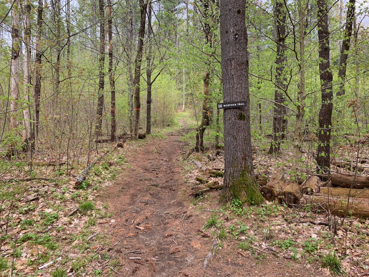
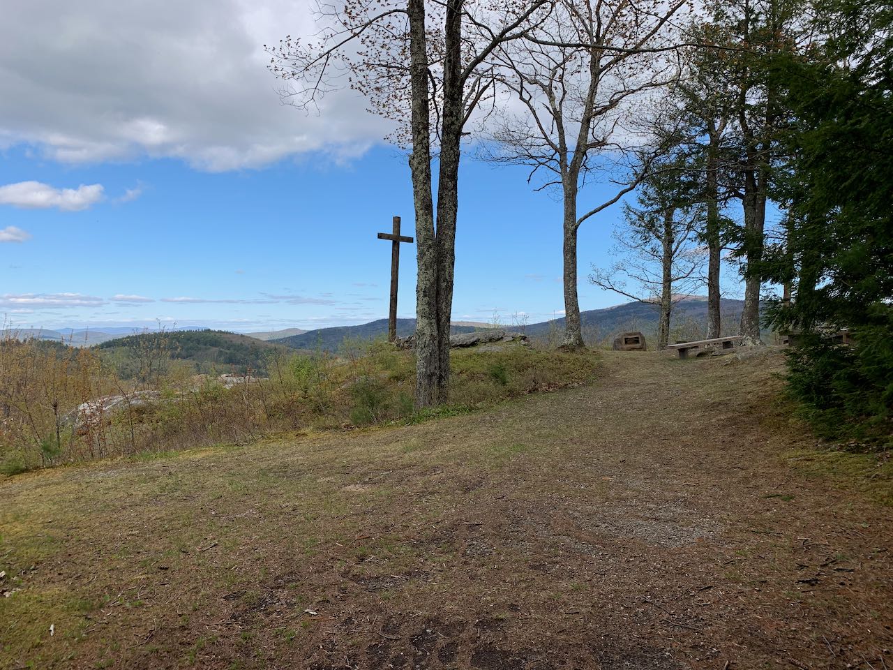
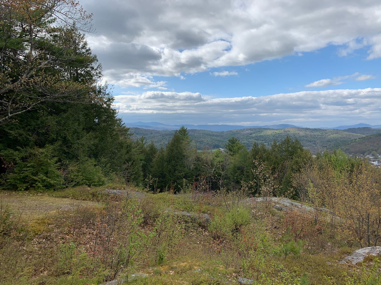
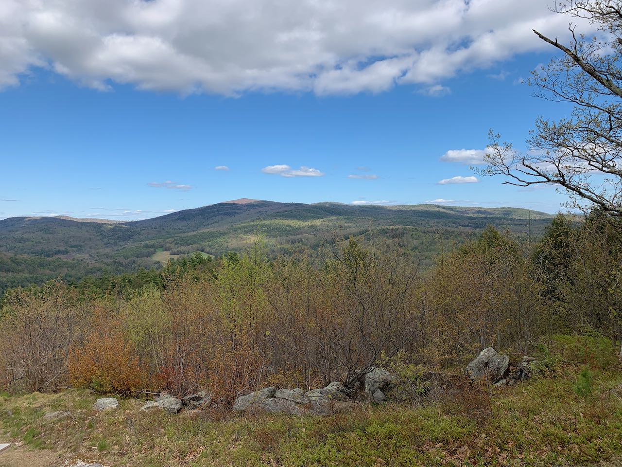
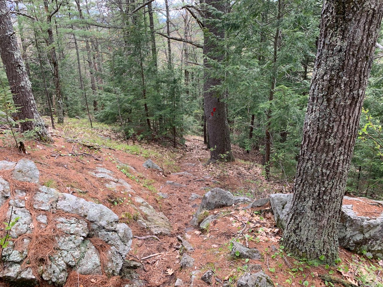
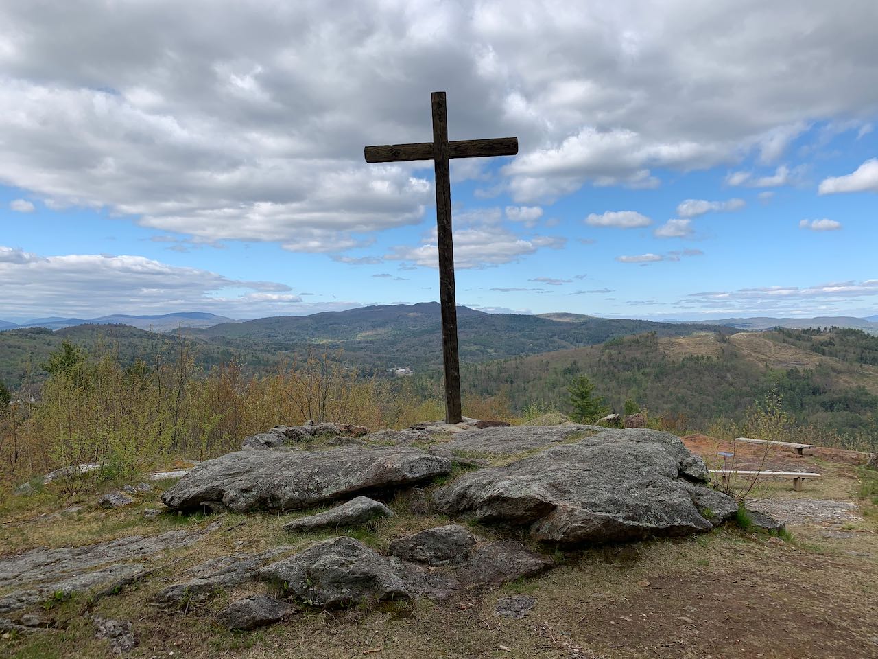
Just outside the town center of Bristol, the Slim Baker Conservation Area offers a nice nature getaway with easy walking trails and great views. The trail network is centered around the Slim Baker Lodge, a venue for educational nature programs. The twin peaks of Roundtop rise between the mouths of the Newfound River and the Smith River at the Pemigewasset. The trail network covers a very limited area, but offers some nice walks around the lower of the two peaks, termed "Little Roundtop". For the most direct route to the top, head to the far side of the parking area, staying to the left of the path to the lodge, and hike up the Worthen Trail. It rises gently uphill, joins a wider gravel path past an open field, and comes out to the summit clearing after just 0.2 miles. The spacious hilltop features an outdoor chapel with a cross affixed to a ledge outcrop. There are panoramic views of nearby hills, with rows of more distant mountains behind. All the way to the left, you can see Mt. Cardigan and the long Elwell Ridge extending right to Bear Mountain. Further over, above the tops of the buildings in the center of Bristol, are Mt. Crosby and Tenney Mountain. Next over to the right is Plymouth Mountain. To the right of that, closer by, are the jagged peaks of aptly-named Peaked Hill. Straight out from the clearing in the distance is the Ossipee Mountain Range. Furthest to the right, most of the eastern view is occupied by nearby Hersey Mountain. For some variety on the descent, head to the back of the clearing and follow the right branch of Stephens Trail (next over to the right from where you came up). It runs across the moss-coated top of the hill and descends a bit more steeply through a rocky forest, ending near the back of the Slim Baker Lodge after a quarter mile. Follow the road back to the parking area.
Printable directions page